- Thursday, 4 June 2026
Western pressures make pre-monsoon more active this year
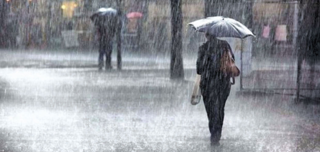
Kathmandu, May 15: The country is seeing an unusual pre-monsoon weather pattern this year with western weather systems causing frequent rainfall. It will possibly reduce the gap before the monsoon arrives, which is scheduled to start from first week of June, meteorologists said.
They said this year’s unusually active pre-monsoon weather pattern is being driven largely by western disturbances and moisture systems originating from regions around the Arabian Sea, Red Sea and Mediterranean Sea, resulting in frequent rainfall across the country.
According to meteorologist Ujjwal Upadhyay, the current weather pattern differs from Nepal’s usual pre-monsoon system, which is generally influenced more by moisture and depressions forming over the Bay of Bengal.
“In previous years, pre-monsoon systems were mostly driven from the east through the Bay of Bengal,” Upadhyay said. “This year, however, there has not been significant formation there. Instead, the systems are becoming active from the west, which is relatively unusual.”
He said weather systems originating around the Red Sea, Mediterranean region and Arabian Sea had been moving through Pakistan and northern India before entering Nepal through high-altitude western wind systems.
“As these systems carry colder air, clouds are converting into rain more quickly,” he said. “In the past, clouds would often gather without producing much rain, but this year the cold air currents are helping rain clouds develop more easily.”
Upadhyay said the ongoing rainfall was part of a continuous pre-monsoon process that could persist until the arrival of the monsoon.
“There may not be much gap between the current pre-monsoon activity and the onset of monsoon this year,” he said, adding that rainfall was likely to continue for at least another two weeks.
He said the changing weather behaviour could also be linked to broader climate change impacts, although further research was needed to understand the exact causes. “This changing weather pattern could definitely be one of the consequences of climate change,” Upadhyay said.
He also advised travellers and trekkers to remain cautious during the afternoon and evening hours, when short-duration but intense rainfall is more likely.
Min Kumar Aryal, a senior meteorologist at the Meteorological Forecasting Division under the Department of Hydrology and Meteorology (DHM), said the current rainfall pattern across Nepal was part of pre-monsoon activity.
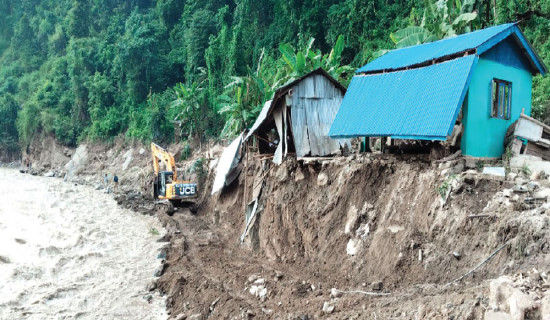
“This is not monsoon rain. It is still pre-monsoon activity,” Aryal said. “At present, there is some moisture supply in the lower atmosphere, particularly in the eastern region -- mainly in the hilly and mountainous areas of Koshi, Bagmati and Gandaki provinces -- which is causing rainfall.”
He said the rain being witnessed now was mostly isolated and scattered in nature, rather than widespread heavy rainfall. “There is no question of continuous rain without a break until the monsoon arrives,” he said. “The monsoon enters Nepal only after certain meteorological criteria are met.”
Aryal explained that the monsoon generally begins around June 13, which is considered Nepal’s normal monsoon onset date. He added that the current weather pattern was still driven by local systems and temporary moisture flows rather than monsoon winds.
“For monsoon conditions to develop, there must be a reversal of the wind system and a sustained south-easterly flow extending from the lower atmosphere up to around four to five kilometres above the surface,” he said. “That kind of monsoonal flow is not present now.”
According to him, moisture-laden winds are currently causing rainfall mainly in the hills through a process known as orographic uplift, where clouds collide with mountain slopes and trigger precipitation.
“There has not been any major rainfall so far,” Aryal said. “The rain is generally light to moderate, but because clouds keep returning throughout the day, people may feel like it has been raining continuously.”
He said local weather systems were being supported at times by small low-pressure systems and moisture flows from the south-east and even from the Arabian Sea, which occasionally trigger rainfall in isolated areas.
Aryal said light to moderate rainfall was likely over the next two to three days, especially in the hilly regions of Koshi, Bagmati and Gandaki provinces. Rainfall in Madhes Province and other areas is expected to remain relatively light.