- Saturday, 6 June 2026
Drainage of supraglacial lake suspected for Rasuwa flood
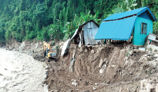
Kathmandu, July 10: The flash flood in the Bhotekoshi on Tuesday morning is suspected to have been caused by the drainage of a supraglacial lake. This lake began forming as a small pond in late December 2024 and expanded significantly by June 2025, experts said.
Supraglacial lakes are lakes that form on top of glaciers, especially in areas covered with rocks and debris. They are often short-lived and change quickly. These lakes usually start as small ponds from melting ice, and over time, they can grow bigger or join with other ponds to form larger lakes, according to the International Centre for Integrated Mountain Development (ICIMOD).
According to information shared by Dr. Nitesh Khadka in Facebook on Wednesday morning, with support from Dr. Guoxiong Cheng of the Chinese Academy of Sciences, satellite images clearly showed water flowing over the surface and through the inner part of a debris-covered glacier in the high Himalayan region north of Rasuwa.
Dr. Khadka suggested the lake drainage could have caused the flood. However, he said that this is only a preliminary analysis, saying, “Further monitoring and detailed study are needed.”
Satellite images shared by Dr. Khadka on Facebook, who is currently studying at the Chinese Academy of Sciences, showed a supraglacial lake, formed on the surface of a debris-covered glacier in the Chinese territory above Rasuwa, which appears to have drained.
Glaciologist Dr. Rijan Bhakta Kayastha said the flash flood was caused by the drainage of a supraglacial lake, likely triggered by rising temperatures. “The lake seen in the image had rapidly expanded about two months ago. Although it does not appear very large in the image, the drainage seems to have occurred from within the glacier,” he explained.
He added that the same glacier still contains a large number of supraglacial ponds, which could also drain in the future. The surrounding area has many other glacial lakes and supraglacial ponds, including one that is classified as a Potentially Dangerous Glacial Lake, he said.
According to Dr. Kayastha, “This was a small amount of water that came from upstream, but 70 to 80 per cent of the water still remains, and it could pose a danger to people living in the Bhotekoshi River basin. The National Disaster Risk Reduction and Management Authority (NDRRMA) should now monitor satellite images and identify high-risk glacial lakes, so that people in low-lying areas can be alerted in time.”
The Melamchi or Helambu event of 2021 was different from the Rasuwagadhi event. “Rasuwagadhi event was due to draining of water stored in supraglacial ponds/lakes but the Melamchi disaster was due to heavy snowfall and rainfall a few days before and washed away debris in the old permafrost area at Bhemanthang. Disaster like the Rasuwagadhi of Wednesday may increase in coming days mainly due to increase in temperature in glacierised river basins of Nepal and Tibet, China,” he said.
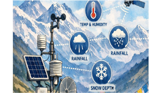
He suggested installing rain and snow gauges and temperature sensors at high elevations (above 3,000 m), two to three automatic water level sensors at high to lower elevations for EWS and analysing satellite images to know the changes specially from May to September each year.
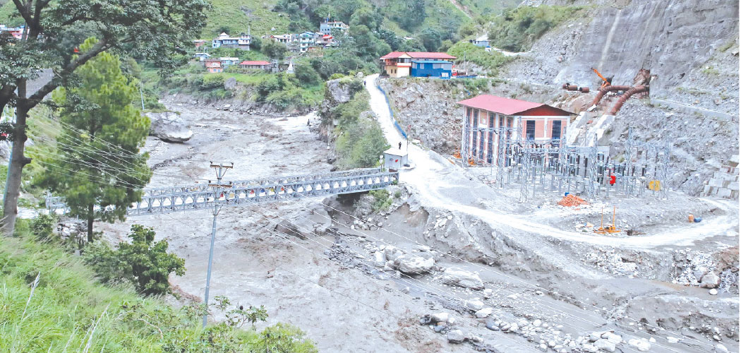
Stating that no infrastructure should be built near the riverbanks, Dr. Kayastha said Rasuwagadhi dry port was built in the worst location, encroaching the river.
Likewise, Binod Parajuli, a hydrologist and chief of the Flood Forecasting Section of the Department of Hydrology and Meteorology, said that after comparing images taken before and after the flood, three small lakes were identified. However, the exact volume of water in the lake that caused the flood is still unknown.
These lakes are located about 26 kilometres upstream from the border point. We are currently making assumptions based on remote data, but a field study is necessary to determine the exact cause of the flood, he said.
“As the dense cloud formation has hindered taking clear images of places surrounding Nepal and China border with the help of satellites thereby making it more difficult to assess the situations on the ground. We are investigating this and will release our findings after a detailed study,” Parajuli said.
According to a press statement issued by ICIMOD on Wednesday, recent GLOF events have occurred by the draining of newly formed (Supraglacial) ice dammed glacial lakes. This includes Tuesday's flood in Bhotekoshi in Rasuwa, and the rock avalanche in the bedrock dammed glacial lake and sequential breach of moraine dammed glacial lake in Thame, Everest region last year.
It said that temperature rise is known to play a key role in the increasing ffrequency of glacial origin floods, in two key ways --first the formation and gradual expansion of glacial lakes -- a longer-term process driven by sustained warming and the second, short-term temperature extremes on individual days can act as triggers for sudden events such as ice avalanches, ice calving, or slope failures related to permafrost thaw.
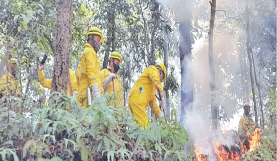
At least nine people have died, and 19 others remain missing following a massive flash flood that lasted until Tuesday night.