- Friday, 5 June 2026
Sediment accumulation impedes Saptakoshi’s flow
BY BABURAM KARKI
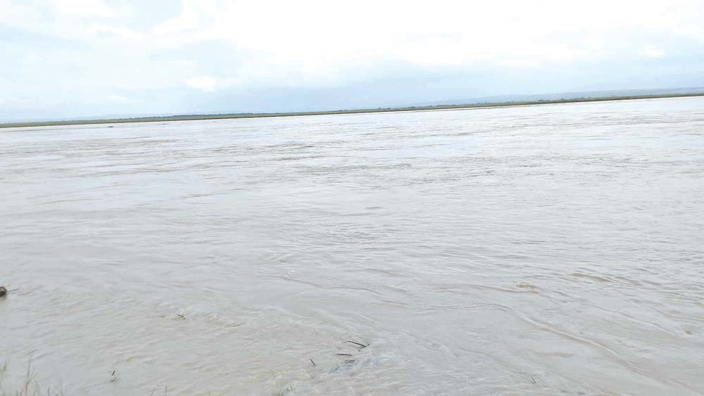
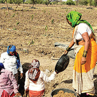
Barahakshetra, Aug. 5: The sandy islands visible during the winter season in the Saptakoshi River have disappeared under rising water levels brought by the monsoon rains. With the onset of rainfall, the river's surface has risen significantly, submerging the islands that once dotted the riverbed during the dry season.
Locals who grew up along the banks of the Saptakoshi recall that the river’s surface has changed drastically over the years. Due to annual sediment deposits, primarily sand and gravel carried by monsoon floods, the riverbed has been gradually elevating. This has caused visible changes to the river's flow and depth, according to residents.
Krishna Prasad Nepal, 86, of Barahakshetra-10, said, “The river I knew in my childhood no longer exists. It has changed as we have aged. Earlier, the river flowed far from the embankments, but for the past three decades, it has been brushing against the eastern embankments.”
Experts and residents agree that the unmanaged buildup of sediment is leading the river to alter its course year after year. “Koshi was once deep, now it's gradually being filled with sand,” said Nepal. He emphasised that the river never had a fixed path and often changed its course, sometimes flowing west, sometimes through the centre, and sometimes near the eastern embankment.
According to locals, the accumulation of sand and gravel has raised the river’s bed to such a level that even small floods now appear massive. Lal Bahadur Limbu of Barahakshetra-9 said, “In recent years, even a minimal rise in water level results in large-scale flooding. During monsoon, the fear of flooding keeps many residents awake at night.”
Bir Bahadur Karki, another local, said that while the river fills with sandy islands in winter, monsoon floods bring silt, clay, and gravel that further elevate the riverbed. “When standing near the embankments, it now appears as if the river flows at a higher level than the village itself,” he added.
The Saptakoshi River is Nepal’s largest, formed by the confluence of seven major tributaries: the Sunkoshi, Dudhkoshi, Indrawati, Tamakoshi, Arun, Tamor, and Likhu rivers. These rivers originate from Mt. Kanchenjunga in the east to the Langtang region (Gosaikunda) in the west. Over the years, the heavy influx of sediment from these tributaries has contributed to the rise of the riverbed.
After ending the hills at Chatara in Barahakshetra, the Saptakoshi spreads into the plains, forming shallow river islands due to accumulated sand and silt. Locals said that one major cause for the buildup of sediment was the obstruction caused by the gates of the Koshi Barrage. Constructed in 1962, the barrage gates are reportedly opened by India only when deemed necessary, which prevents the outflow of sediment and allows it to accumulate in the river.
Limbu, who is also the Vice-President of the Saptakoshi Inundation, Erosion, and Flood Victims Struggle Committee, said the river has consistently raised its level and shifted its course each year because of this unmanaged sediment. He added, “If all the barrage gates were opened during minor and major floods, the sand could be flushed away, reducing the risk.”
Experts and concerned organisations warn that immediate action must be taken to manage sediment from the riverbed if the Saptakoshi is to return to its natural state. Failure to do so may worsen the annual monsoon flooding and erosion in surrounding areas.
Local communities continue to call for coordinated action among authorities to improve the management of the river and the barrage, emphasising that timely intervention is crucial to prevent future disasters.


-square-thumb.jpg)