- Monday, 4 May 2026
Another landslide sparks fear in Til village of Limi
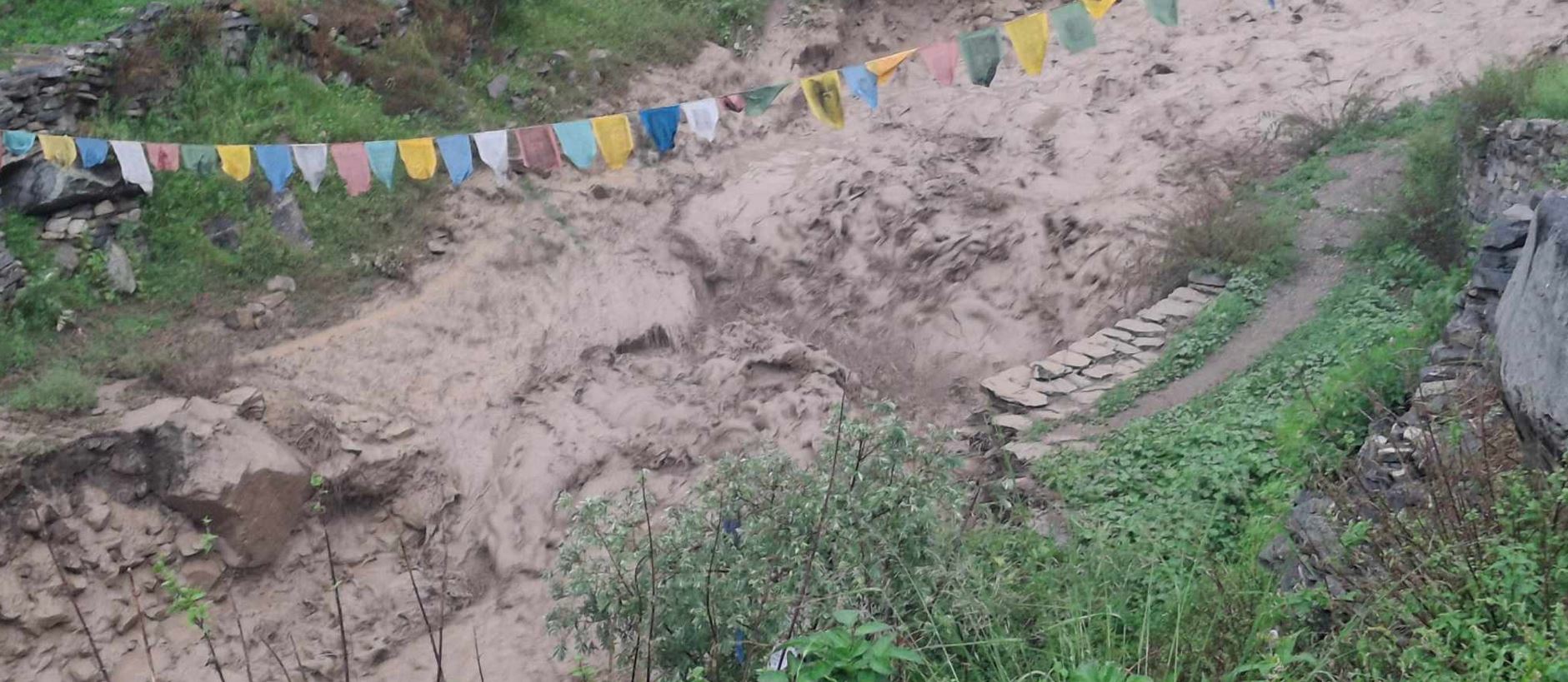
Scene of the landslide that struck Til village, Humla on Monday night. Photo: TRN
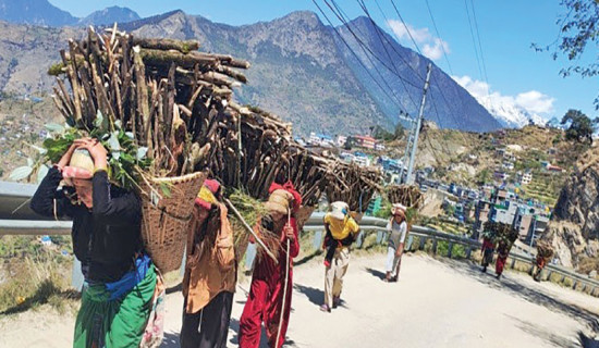
By Rajan Rawat,Humla, July 30: Residents of Til village in Limi, located in Namkha Rural Municipality-6 of Humla district, are gripped with fear after another landslide struck the area on Monday night.
According to ward member Tundup Lama, this new landslide occurred at a different spot from the previous one, causing great concern among the villagers. A massive landslide, along with mud, fell into the stream southwest of the village, sweeping away the wooden bridge that connects Til village to Hilsa.
“At first, we thought the landslide had hit the same area, but later we realised it struck the main trail leading to the village. Now the villagers are in panic,” Lama said.
He added that with landslides on both sides of the village, there is now no visible alternative route in or out of Til village. He called for the immediate relocation of the villagers to a safer area.
Ward Chairperson Paljor Tamang confirmed that this recent landslide came from a different area than the one on May 14, 2025, which had occurred in the Tiljung stream.
This time, the landslide originated from the Syogan stream, which flows from the northwest of the village. Tamang, who had just entered the village through the affected area, said the villagers who had recently moved back from tents to their houses are now again facing difficulty in movement and living in fear.
There are glacial lakes located in the upper reaches of the Syogan stream. Upon hearing of the incident, Ward Chair Tamang reached the village on Tuesday.
Previously, on May 14, 2025, water from two glacial lakes in the upper catchment of the Tiljung stream had burst out, triggering a landslide. At that time, the villagers had already decided to collectively leave the village due to safety concerns. With this latest landslide hitting another key location, that decision now seems even more urgent. Currently, 23 households live in Til village.
Meanwhile, a landslide occurred in a stream near Halji village. Though it caused no damage, it is suspected to have been triggered by a glacial movement as well. A large glacial lake also exists above Halji village.
Meanwhile, our Mustang correspondent Harikrishan Sharma reported that the Kagbeni-Korala road linking Upper Mustang has been blocked after the water level in Kagkhola rose sharply.
According to Deputy Superintendent of Police (DSP) Chiring Kippa Lama, the flooding that began last night in Kagkhola disrupted traffic along the Beni-Jomsom-Korala section, especially near Chhusang in Baragung Muktichhetra Rural Municipality-3.
This road connects Lower Mustang to Lo-Ghekar Damodarkunda and Lo Manthang rural municipalities in Upper Mustang. “We have brought a JCB to clear and repair the road. We urge travellers to take precautions while travelling during the monsoon season,” Lama said.
All vehicles using the regular route through Kagbeni have been halted since early morning, as alternative roads to Upper Mustang are also risky due to landslides and the swollen Kali Gandaki River.
During the monsoon, floods and landslides frequently block the road at the Tangbe stream in Chhusang and near the Mustang Gate. This stretch is considered the main gateway to Upper Mustang.
The District Administration Office Mustang has issued a public notice advising travellers not to travel at night along the national highway that passes through Thasang, Gharapjhong and Baragung Muktichhetra.
In recent years, with more frequent rainfall in Mustang, locals of Lo-Ghekar Damodarkunda and Lo Manthang have been facing increased risks of floods and landslides.