- Thursday, 11 June 2026
Wetter, longer monsoon in the air

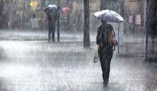
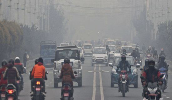
Kathmandu, May 5: As the pre-monsoon season nears its end, the country has been receiving significant rainfall across various regions, signaling the likelihood of above-normal rainfall by the time the monsoon season begins around the first week of June.
In Kathmandu, significant rainfall has been recorded since the third week of April. Meteorologists said this is a normal feature of the pre-monsoon period, which typically brings light to moderate rain accompanied by lightning and thunderstorms.
According to Pratibha Tuladhar, a senior meteorologist at the Meteorological Forecasting Division under the Department of Hydrology and Meteorology, the latest rainfall is due to the influence of local winds and westerly, along with moisture-laden air from the Bay of Bengal, which is affecting the current monsoon system.
Tuladhar said that more rain is expected from the second week of May, which will signal the approaching monsoon season.
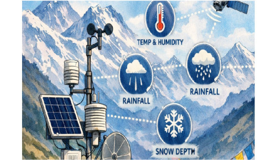
According to Weather and Climate data, Kathmandu received below-average rainfall in April, recording around 46 mm of precipitation, about 74 per cent of the normal April average of 63 mm. However, rainfall increased significantly across the country in May.
At the same time, Statement on the Seasonal Climate Outlook over South Asia for the 2025 Southwest Monsoon Season (June–September), said that most parts of South Asian countries including Nepal is expected to receive above-normal rainfall during upcoming monsoon season.
Maximum temperatures are also likely to be above normal in the northern, eastern, and northeastern regions, and in some southern areas. In contrast, central and southern South Asia may see normal to below-normal maximum temperatures, according to the outlook.
Bibhuti Pokharel, chief of the Climate Division at DHM, said that although the DHM is yet to officially release its monsoon outlook, overall rainfall across the country is expected to be above normal this monsoon season. Temperatures are also likely to remain higher than average.
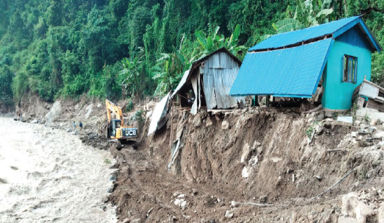
“The rainfall and temperature are both expected to remain above normal, and the higher levels could lead to an increase in extreme weather events across the country,” she said.
Madhukar Upadhya, a watershed expert, said that this year, not only is the monsoon rainfall expected to be above normal, but the monsoon period may also last longer than usual due to a likely absence of the typical gap between the pre-monsoon and monsoon seasons.
“In previous years, there was usually a 10- to 15-day break after the pre-monsoon before the monsoon began, but this year, that pause may not occur as rainfall is likely to continue without interruption,” he said.
He pointed out the possible development of an omega block (a high-pressure system that stalls weather patterns) as a factor that could influence prolonged wet conditions over the region including Nepal, leading to more intense and sustained rainfall.
“If we experience rainfall similar to that of September 27 and 28, 2024, this year, it could lead to more disasters and preparations should begin now,” he said.
According to Tuladhar, light to moderate rainfall is likely to occur across the country on Tuesday following a brief break on Monday.
This pattern of light to moderate precipitation is expected to continue for another three days, mainly affecting Bagmati, Gandaki, Koshi and Lumbini provinces.