- Thursday, 28 May 2026
Lumbini preparing action plan to mitigate flood risks

By Laxman Poudel Bhairahawa, July 2: Lumbini Province is prone to floods and landslides every year. This year, the Department of Hydrology and Meteorology (DHM) has already forecast above-normal rainfall in the province.
The National Disaster Risk Reduction and Management Authority has also informed that there is a risk of floods in the Terai districts and landslides in the hilly districts.
There are 12 districts in Lumbini Province. Of them, six districts of the Terai – West Nawalparasi, Rupandehi, Kapilvastu, Dang, Banke, and Bardiya – are at high risk of floods. Similarly, hilly districts – Gulmi, Arghakhanchi, Pyuthan, Rolpa, and Palpa – are at high risk of landslides. East Rukum, a mountainous district in the province, is not at risk of floods or landslides.
The DHM has drawn the attention of the concerned bodies saying that the risk of floods and landslides will increase due to above-average rainfall in the hilly areas of Lumbini Province.
The floods in Rupandehi, Tinahu, Dang and Banke, Rapti, and Babai rivers have already increased the risk.
According to Rajesh Kumar Mahato, a meteorologist at the Office of the Hydrology and Meteorology, Bhairahawa, it is easy to reduce the risk this year as the monsoon action plan has been prepared as per the need.
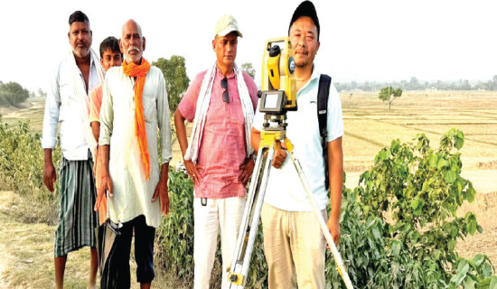
The biggest problem is in Tinau River. One of the two rain and precipitation gauges kept in Tinau Basin has been stolen six months ago. In another, the connection has not been restored since the flood washed away two years ago.
According to Mahato, the device kept in Kerabari was stolen but the police were unable to find it. The gauges kept in Dobhan could not be connected after it was also washed away by the floods two years ago.
“We have asked the Department about the connection of the gauges but no connection has been made so far,” he said. He said that the flow of information was not fast due to the lack of automatic gauges.
According to Mahato, arrangements have been made for device readers to send information about precipitation in Dobhan. But that information is only possible during the day and not at night as it is an awkward place.
“In places where there is a high risk of floods, priority should be given to having automatic rain and precipitation devices. The information given by the gauge reader is no longer practical and slow, he added.
There is a high risk of disaster in Butwal as 13,000 families are living in the floodplain of Tinau River. The floods in Tinau every year have been inundating a large area.
Three years ago, a landslide hit Satyawati in Gulmi. The landslide that hit Isma two years ago is also huge. The entire village in Rolpa’s Sunchahari was affected by the landslide. “Landslides are taking place on the land shaken by the earthquake when there is a lot of rain. The risk of landslides is the same even now,” said geologist Dr. Ranjan Kumar Dahal.
Disaster risk reduction work has been done in Rapti and Bardiya, which are at risk of floods, by installing rain and flood measuring instruments and formulating a monsoon action plan.
Binod Parajuli, chief of the Hydrology and Meteorological Office, Kohalpur, informed that rain and flood measuring devices have been installed to reduce the damage.
It is easy to give an early warning in Rapti as rain and flood measuring devices are also in operation in Rapti bank. Devices are also connected at three places in Dang, Pyuthan and Banke.