- Monday, 4 May 2026
Public Concern Rises Over Chobhar Gorge
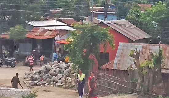
Following the disastrous floods along the Bagmati corridor in September 2024, which claimed 37 lives and caused extensive property damage, a proposal to widen the Chobhar gorge has caused curiosity, doubts, and debates amongst the general public.
The suggestion, initiated by the National Disaster Risk Reduction and Management Authority (NDRRM) and forwarded to the Ministry of Urban Development (MoUD), comes amid growing concern over urban encroachments along the river corridor.
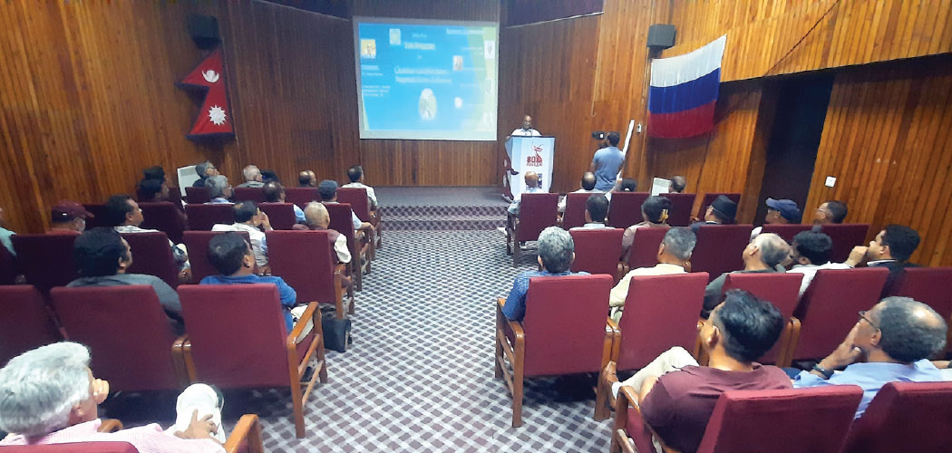
Based on this theme, a meaningful dialogue programme was organised by Mitrakunj, an alumni association of former Soviet and CIS graduates, recently at the Russian House in Kathmandu.
The event was focused on two key topics: "Discussion on Chobhar Gorge Widening" and "Review of the Nagmati Dam Project". The gathering brought together geologists, water resource experts, natural hazard specialists, former government officials, professors, and representatives from relevant departments and projects.
Experts at the event advised against rushing into large-scale interventions like the Nagmati Dam or the widening of Chobhar Gorge, emphasising that such decisions must be based on a comprehensive technical, economic, cultural, and environmental analysis. Many warned that hasty alterations in the sensitive site of Chobhar Gorge could cause irreversible damage to its unique geographical integrity and heritage, which has evolved over thousands of years.
Kamal Ram Joshi, Director General of the Department of Hydrology and Meteorology, noted that in September 2024, the gauge reading at Khokana reached 6.16 meters, with a corresponding discharge of 1130 cubic meters per second, a level statistically associated with a 92-year return period.
Still, specialists say the floods hit so hard not just because of the heavy rain but also because cities keep spreading into the river's natural floodplain and swallowing up green space. In Nakhu, for example, houses now sit right next to – or even on top of – the old river path, blocking the water where it used to flow freely.
Professor Hari Pandit of Tribhuvan University explained that the steep riverbed in the Chobhar gorge area helps maintain fast flow and shallow depth. However, if the gorge is widened, the riverbed would become flatter, significantly increasing flood depth by as much as 10 metres, potentially increasing flood risk upstream. He also pointed out that certain weirs, built under bridges along the Bagmati corridor to protect their foundations, have worsened flooding, and removing these structures could significantly reduce flood levels. Alternative engineering solutions, such as piling around bridge foundations, could protect infrastructure without disrupting river flow.
Professor Narendra Man Shakya, a senior water resources and hydrology expert, emphasised the urgent need to update outdated hydrological parameters. "We still use old 'C' values in the Q=CIA formula to calculate discharge. These must be re-evaluated to reflect current urban permeability and rainfall-runoff characteristics," he stressed.
Shakya advised on comprehensive modelling, including assessments of percolation needs, detention strategies, and the creation of permeable urban spaces. "Before any decision, we need quantified studies, risk-informed decision-making (RIDM), and alternative scenario evaluations. The percolation area and amount of water to be absorbed to prevent a 100-year flood event in Kathmandu should be accurately calculated."
Badan L. Nyachhyon, a senior civil engineer, advised that infrastructural interventions must also consider Kathmandu Valley's rich cultural and historical context. "The Bagmati civilisation is deeply tied to both tangible and intangible heritage. The Chobhar gorge, shaped by flood events over the past 60 million years, is an integral part of the Kathmandu Valley World Heritage Site. Altering it without proper consultation risks both cultural loss and disastrous consequences."
Regarding the fragile stones and rocks near the gorge, Nyachhyon said, "Those stones are not just pieces of geology. They protect nature."
Intended to improve water quality in the Bagmati during the dry season, the proposed 94.5-metre Concrete Face Rockfill Dam (CFRD) has been criticised for its potential risks and questionable efficacy.
Rajan Raj Pandey, an environmental engineer and PhD researcher at Lincoln University in Malaysia, warned that the dam site lies on fractured rock formations and could pose an enormous risk if breached. "A dam break could affect up to 500,000 people, devastate major infrastructure, including the airport, and threaten revered heritage sites like Pashupatinath and Bouddhanath," Pandey said. He also questioned the project's effectiveness, citing the Rs 9.42 billion cost estimate from 2021.
"If the improvement in water quality is negligible, why risk lives and heritage?" Water quality can be improved by increasing wastewater treatment capacity by upgrading existing plants and constructing new facilities while completely stopping the direct discharge of untreated sewage.
Water resources expert Er. Govinda Sharma Pokharel pointed out that addressing floods in Kathmandu, the Chobhar Gorge, and the proposed Nagmati High Dam requires a well-informed understanding based on real observations and historical events.
He noted that by 1993 AD, around ten significant floods had been recorded near Padheredobhan, including the deadly 1981 flood when Lele Khola and Thankot Khola swept away people.
A discharge of 360 cumecs was also observed in Markhu around the same time. He also referenced the 1993 flood, which was intense, when Tistung recorded 540 mm of rainfall in 24 hours, and an estimated 15,000 cumecs discharge was observed in the Bagmati River. Floods of 2002, 2011 (311 mm), and 2023 (360 mm) also pointed toward the heightened risk. These floods, driven by poor governance and the absence of management, turned into disasters that could have been prevented.
Pokharel points out that if a 24-hour rainfall of 540 mm, like that recorded in Tistung, were to fall directly in Kathmandu, the impact would be terrible. Climate change could further intensify such events. Therefore, Kathmandu must be prepared for extreme rainfall of up to 600 mm, with appropriate flood management systems to protect its residents.
Pokharel shared that the Chobhar Gorge is about 18–20 metres wide on average, with nearby settlements 30 metres above. "If floodwaters rise by 10 metres, the Chobhar Gorge can immediately discharge about 2,800 cumecs, keeping settlements 30 metres above safe from Bagmati River floods.
The flood in 2024 was around 1,130 cumecs, well below the gorge's capacity. As for widening the Chobhar Gorge to manage floods in Kathmandu, anyone proposing such an unwise idea hasn't seen Chobhar or Kathmandu. This is because, firstly, there is no basis to believe that the Chobhar Gorge would get blocked, and even if it did get blocked somehow, there are natural outlets in the upper section of the gorge through which floodwaters could easily escape," he added.
Er. Surendra Paudel, project director of the Nagmati Dam Project, stated that the primary objectives of the proposed dam were to generate 1.8 MW of hydropower, improve the water quality of the Bagmati River, and contribute a portion of the flow to Kathmandu's drinking water supply. However, the project has been put on hold in response to public feedback and concerns, and alternative solutions are currently being explored.
Chobhar Gorge can handle four times the floodwater it did last year. This shows we urgently need a thorough hydrological study of the Bagmati watershed, looking at land use, changes to the land surface, and how water is diverted.
Chobhar Gorge's natural water system requires preservation due to its significant geological value. Construction is prohibited. Proven international flood control methods should be investigated for local implementation.
Experts stressed the need for inclusive and well-informed engagement with all stakeholders. They said open discussions, expert debates, and public seminars are vital to build understanding and find solutions that fit the local context. They also warned against rushing into building or tearing down structures in areas prone to flooding, urging instead safer, more sustainable alternatives that respect the natural flow of rivers.
(Shrestha completed a master's in professional engineering from the University of Technology, Sydney.)

-original-thumb.jpg)