- Tuesday, 1 July 2025
Disaster-hit Districts
The 26th meeting of the executive committee of the National Disaster Risk Reduction and Management (NDRRMA), held the other day in Singah Durbar, recommended that the government declare various local levels in 14 districts as disaster crisis-affected areas for the period of three months. Panchthar, Okhaldhunga, Sindhupalchowk, Makwanpur, Chitwan, Lalitpur, Sarlahi, Dhading, Dolakha, Ramechhap and Kavrepalanchok, Udaypur, Sindhuli and Rautahat are the districts that borne the brunt of the recent rain-induced disasters. Merely declaring disaster-hit areas and making tepid and also delayed recovery efforts will only add to people's frustration; we must also look for ways to mitigate the impact.
In its effort to recover from the recent devastating rain-caused disasters, the government has announced plans to bring all highways, except the BP Highway, into operation within the next three days. Besides claiming and injuring hundreds of lives, the calamity has laid waste to bridges, highways and other critical infrastructure. As many as 14 hydropower projects have sustained damages, forcing several to go out of service. As the government counts the cost of damage, as least Rs. 20 billion is said to be needed to restore the infrastructure and get them back on feet. This is indeed a huge economic blow for a poor country.
The perfect storm of climate change and man-made factors – including poor urban planning that allowed chaotic construction to disturb natural river system – is claimed to have added to the frequency and severity of the flooding and landslides. What's more, unregulated crusher industry is also to blame for the floods of monumental scale, experts point out. When such industries extract stones, sand, gravel and other materials from hills, mountains and river banks to be crushed for construction of building and then dumps the fine-grained residual sludge or slits into the river, it results in river getting shallower. With shrinking depths to accommodate growing floodwater, the excess water is spilled over into nearby surroundings. In the case that these immediate surroundings happen to be settlements, they get inundated. And this is exactly what happened in river-bank settlements.
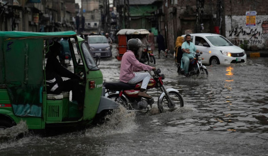
A great deal of stride has been made in the construction of earthquake-resistant houses across the country, galvanised by the catastrophic impacts of 2015 earthquake. The same must happen in the case of urban planning. Drainage and sewer system especially in the Kathmandu Valley has clearly failed to keep up with the population growth. This fact was starkly visible when overwhelmed drainage sent the floodwater into nearby areas, inundating settlements and turning roads into rivers. Cities are the reflection of civilisation; making them withstand the wrath of nature is what determines their longevity.
Urban development has also led to deforestation. Forested land helps hold water and also prevents runoff of water. As cities have turned into concrete jungle with pavements everywhere, floodwater have little option to escape, worsening the flood situation in urban areas. Rampant deforestation has also made them vulnerable to flooding. Elaborately meticulous planning that take into account every probable events and scientific land use policy, as well as a powerful mechanism to strictly enforce the mandated guidelines must be drawn up if we are to stave off the repeat of such disasters in the future. Also, there is much more to be done in our disaster preparedness measures.


