Saturday, 20 April, 2024

The entire country is looking up to the government to resolve the Kalapani border issue with India as the southern neighbour published a map showing Kalapani area in its territory. The government has taken proactive steps by issuing a statement against the Indian move and said that the entire Kalapani region including Lipulek and Limpiadhura were Nepal’s territory.
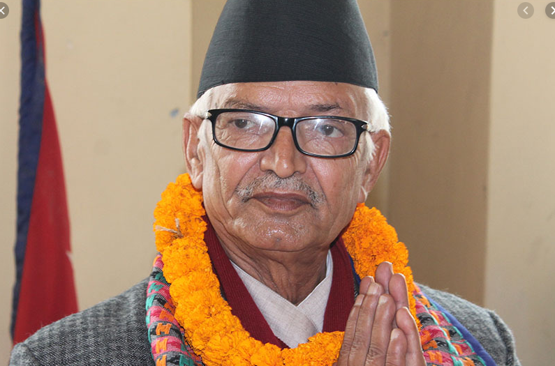
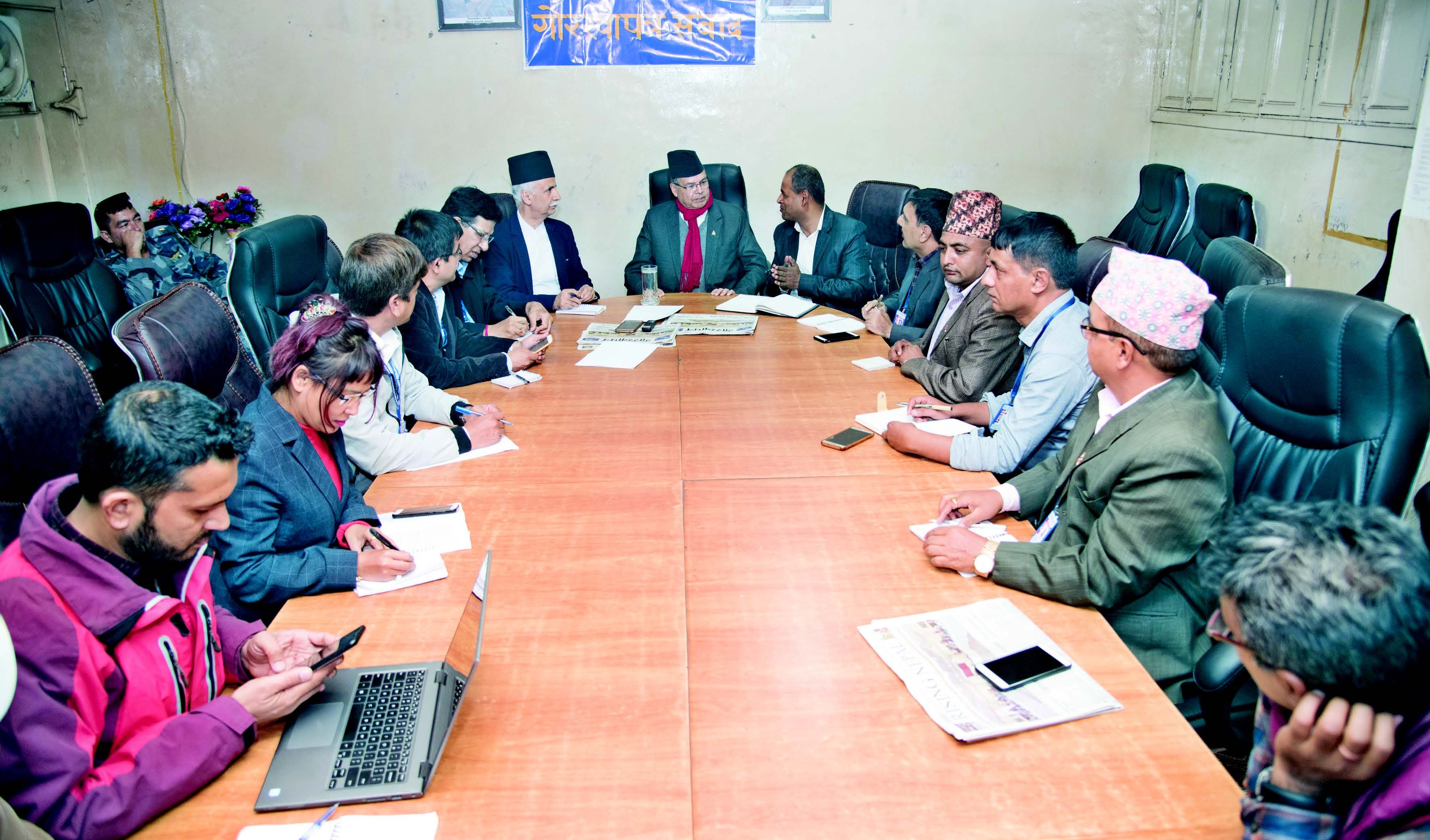
Prime Minister KP Sharma Oli called an all-stakeholders meeting, including the leaders of opposition parties, former prime ministers and foreign ministers, and discussed the further moves regarding the matter. Experts, politicians and opinion makers are speaking against the Indian encroachment at Kalapani region which is about 350 square km. India has encroached Nepali territory at various 76 locations. In this backdrop, we talked to Former Prime Minister and Senior Leader of Nepal Communist Party Jhalanath Khanal at the weekly dialogue series ‘Gorkhapatra Sambad’. Excerpts:
How do you assess the issue of Kalapai, Lipulek and Limpiadhura?
It’s not just about Kalapnai, Lipukek and Limpiadhura, but about setting our national boundary as per the Sugauli Treaty. All Nepalis should read and understand that treaty yet again. It clearly says that the Mahakali River is the western boundary of Nepal. The country missed the chance to secure its own land from the very beginning.
There are many tributaries of Mahakali river and there is a challenge to decide which is the main river and which is its tributary. Two rivers each from Limpiadhura and Lipulek are creating confusion as per Indian opinion. The identification of the main river can be done through the study of the hydrology: length of the river, volume of water in the river and catchment area. The river from Limpiadhura, Kutiyangdi, is more than thrice longer than the one that originates from Lipulek. Similarly, the amount of water flowing in the river and catchment area both are greater in Kutiyangdi. Kutiyangdi means Kali in local language. These are strong evidence for the identification of the Mahakali river, the borderline of the two countries.
Limpiadhura is the trilateral point among Nepal, China and India. Most of the area there is no man’s land. Most of the time the area is covered with snow. Nepal conducted census in the three villages in the Kalapani region, in the villages east of Limpiadhura, in the past as well. Census officer Bhairav Risal has recently spoken about the presence of Nepal government there. Those villages are occupied by the Indian forces. India has even come farther east from Lipu stream and presented a small spout near a local Kali temple as the source of the Mahakali River.
This issue was raised in the Parliament during early 1990s and the Parliamentary Inspection Team led by then Speaker Daman Nath Dhungana inspected the area. I was also in the team, and we found the situation in Kalapani grave, our land was encroached for many years in the past. We recommended the government to take required actions and hold discussions with India, but the governments then ignored the suggestions. The Indian map has shown even Tinker Bhanjyang in Indian territory. It is natural that people in Nepal have resented the move of the southern neighbour.
With a motive to resolve the issues, Prime Minister KP Sharma Oli called an all-stakeholders meeting on Saturday. All political parties and stakeholders stood together in getting back the encroached territory. There is an unprecedented national unity on the issue. All the national forces have the same voice that the territory of the country set by the Sugauli Treaty should be protected.
India has said that the map was not the new one, but they had been using the same map for many years in the past and the new map was published to show Kashmir’s boundary. Have we suddenly come to know that our territory was shown as the part of India?
We delayed in claiming our territory. After the Sugauli Treaty, various maps of the South Asian region were published. Maps were published in 1816, 1840 and 1860 as well. If you see the maps of 19th century, Limpiadhura is shown in Nepal’s territory. Indian maps in the 20th century have shown Lipulek as their land while the recent maps have shown further encroachment, about additional 50 km in Nepal’s side. On the other hand, Nepali maps also include Kalapani region in its territory.
There is no dispute that Kalapani region is Nepal’s territory. There are evidences including the Nepali census, maps, treaties and payment of land revenue by local people to the government. We have a collection of strong evidence on the issue. The country will resolve the problem in an amicable way with national unity.
What should the government immediately do?
The government should first create a position paper. It must search all past agreements, treaties, maps and chronological events and include them in the position paper. Then it should create a unified opinion of the people and educate them regarding the matter. Similarly, Nepal should enhance the security at the international borders at the earliest and the security forces must be increased to meet the security demand. More border posts must be created, and the entire border security mechanism, including the resources and institutions, should be strengthened.
It has also been said that there were a couple of other agreements about the borders post Sugauli Treaty?
With the 2-year long war with the British forces, Nepal and then British Government in India signed the Sugauli Treaty in 1816. With another treaty in 1818, Nepal got back the lost land in eastern region, and in 1860, Nepal received the new territory in Banke, Bardiya, Kailali and Kanchanpur. But there were no treaties or agreements regarding the border management and settlement. Sugauli Treaty is the only document in terms of international borders, and no party has authority to change it on their individual whim.
Do we have any evidences of when India started claiming Nepali territory as its own?
This is a difficult question and we can’t pinpoint the time when the encroachment started. The Indian government immediately after the liberation in 1947 was scared of the influence of communism due to the Chinese revolution at the same time. To protect India from the communism, it deputed Indian forces at the northern border in Nepal with China. Our assumption is that India had stationed its forces in Kalapani somewhere during the same time.
The location is a strategic place. Lipulek is the main entry point to Mansarovar, a sacred lake in Tibet. Similarly, near to it is Tinker Bhanjyang which is the famous trade route and has high touristic and strategic importance. If we study the agreement made by the then Prime Minister Matrika Prasad Koirala and Indian government in 1952, we may have clue about the time Nepal allowed the Indian government to set post at the Chinese border. It was a huge blunder on the national sovereignty and integrity on the part of then government. Another assumption is that when a war broke out between India and China, the former stationed its troops in Kalapani.
There is a question about Chinese collusion in the matter. China and India agreed to use the Lipulek to facilitate trade between the two countries. Chinese PM Li Keqiang and his Indian counterpart Narendra Modi agreed for the same. Does it mean that China endorses Indian map? Or should we hold talks with China as well?
Limpiadhura is a tri-lateral border point, and without fixing the point our western border couldn’t be determined. It is possible only with the consent of all three countries – Nepal, India and China. We disagree with the agreement reached between India and China regarding the Lipulek or Kalapani. We have expressed this view with both parties. We want a tripartite agreement regarding the border point. Lipulek is not the trilateral point but Limpiadhura is.
A Common notion is that China is more favourable in terms of Nepal and its development while India is more hegemonic. But they both stood together while snatching away Nepal’s land.
We are not tilted to any of the big neighbours. We are Nepal-oriented. We might like the political system of certain country, but it does not mean that we are tilted to it. We should not and must not fall in the ambit of any of the powers. We are neutral and non-aligned country from the beginning. I think the non-alignment is the principle that Nepal should adopt.
Has the Eminent Persons Group (EPG) report include any recommendation about border disputes, particularly on Kalapani and Limpiadhura?
There are many other issues between Nepal and India other than the borders. Nepali people long wanted to review the unbalanced 1950 Trade and Transit Treaty with India. The then PM Manmohan Adhikari had expressed this sentiment to the Indian government. Both the government agreed to look into the matter. Foreign Secretaries of both the countries hold a meeting on the issue but it ended inconclusively.
EPG is a positive and proactive development in terms of the bilateral relations between the two countries. It reviewed the 1950 treaty, border issues including Limpiadhura and other many concerned areas. But despite Nepal’s multiple requests, the Indian government has not accepted it although it is a document of consent between the two countries. It could be instrumental in resolving the current issues and challenges.
Nepal wants to regulate Nepal-India border while India wants to keep it open in the name of ‘bread and daughter’. What could be India’s interest in it?
There are international laws and conventions regarding the international borders. It can’t be settled on the whim of any country and regional power. We have problems at multiple locations at Nepal-India border which needs immediate actions. The no man’s land is encroached and the border posts (Jange Pillars) are being shifted over-night. All the international borders should now be set with the use of advanced digital technology. Once the border is set with hi-tech method, it cannot be changed in any way.
Are there any other documents after the Sugauli Treaty that could help to resolve the issue?
We only follow the Sugauli Treaty, there are no alternatives. For us there are no other treaties. We don’t follow the borders set by India and China.
Do you see the prospects of getting back the lost territory of Nepal as per the Greater Nepal concept? Even the 1950 treaty has a provision that Nepal could get the lost territory.
This is a question of history and a matter of academic discussion. It is not a current political question. However, we need to be pragmatic. At first, we must protect the set boundaries of the country.
Nepal’s international relations have witnessed a tremendous developments. Do you see the prospects of resolving the international issues in the leadership of current government?
Of course. Nepal has come to an important height in the history with the conclusion of all political agenda. The country has powerful government with two-third majority which has ensured political stability. It can lead the country to a new era of development and prosperity. It can pass the national interest agenda from the parliament as well. Most importantly, the country has a national consensus on Kalapani region. This consensus is a powerful force. Now we stand at a point of national unity.
Likewise, India also has a powerful majority government. Both the governments can resolve the issue with parliamentary backing. Moreover, both are in historically good terms. We must not think that the publication of the map has not dragged the relations between the two countries down. So, this is an opportune time to resolve the issues like Kalapani. Challenge and opportunity are the twins.
Should we go to the United Nations or the International Court?
It is like trying to reach the highest rung of the ladder at once. It is neither desirable nor possible. There can be accidents, we must make a gradual ascend. The government has started a good initiative which will not stop without a resolution.
We in Nepal seem to be reactionist regarding these issues than taking actions. The past governments and communist party itself just raised the issue but let is halfway without resolution. Why?
As an opposition party the CPN (UML) had sent a delegation to India and talked to then PM Atal Bihari Bajpayee, but he wanted a formal delegation and proposal from the government. We raised the issue to then PM Girija Prasad Koirala about it, but he made no moves. Now the ruling and opposition parties are standing together. There was not such moment in the past.
What role can media play in such scenario?
Media has a crucial role to play on such issue by creating awareness among the people and giving suggestions to the political parties, government and other stakeholders. Media also can publish the historical facts. This historical publication should lead the media in terms of national interest.
(Prepared by Modnath Dhakal. Photo by Sagar Basnet)

Do not make expressions casting dout on election: EC
14 Apr, 2022
CM Bhatta says may New Year 2079 BS inspire positive thinking
14 Apr, 2022
Three new cases, 44 recoveries in 24 hours
14 Apr, 2022
689 climbers of 84 teams so far acquire permits for climbing various peaks this spring season
14 Apr, 2022
How the rising cost of living crisis is impacting Nepal
14 Apr, 2022
US military confirms an interstellar meteor collided with Earth
14 Apr, 2022
Valneva Covid vaccine approved for use in UK
14 Apr, 2022
Chair Prachanda highlights need of unity among Maoist, Communist forces
14 Apr, 2022
Ranbir Kapoor and Alia Bhatt: Bollywood toasts star couple on wedding
14 Apr, 2022
President Bhandari confers decorations (Photo Feature)
14 Apr, 2022